Data Collection - COGS Property
November 2018, «Introduction to Mapping and Geodesy» at Centre of Geographic Sciences
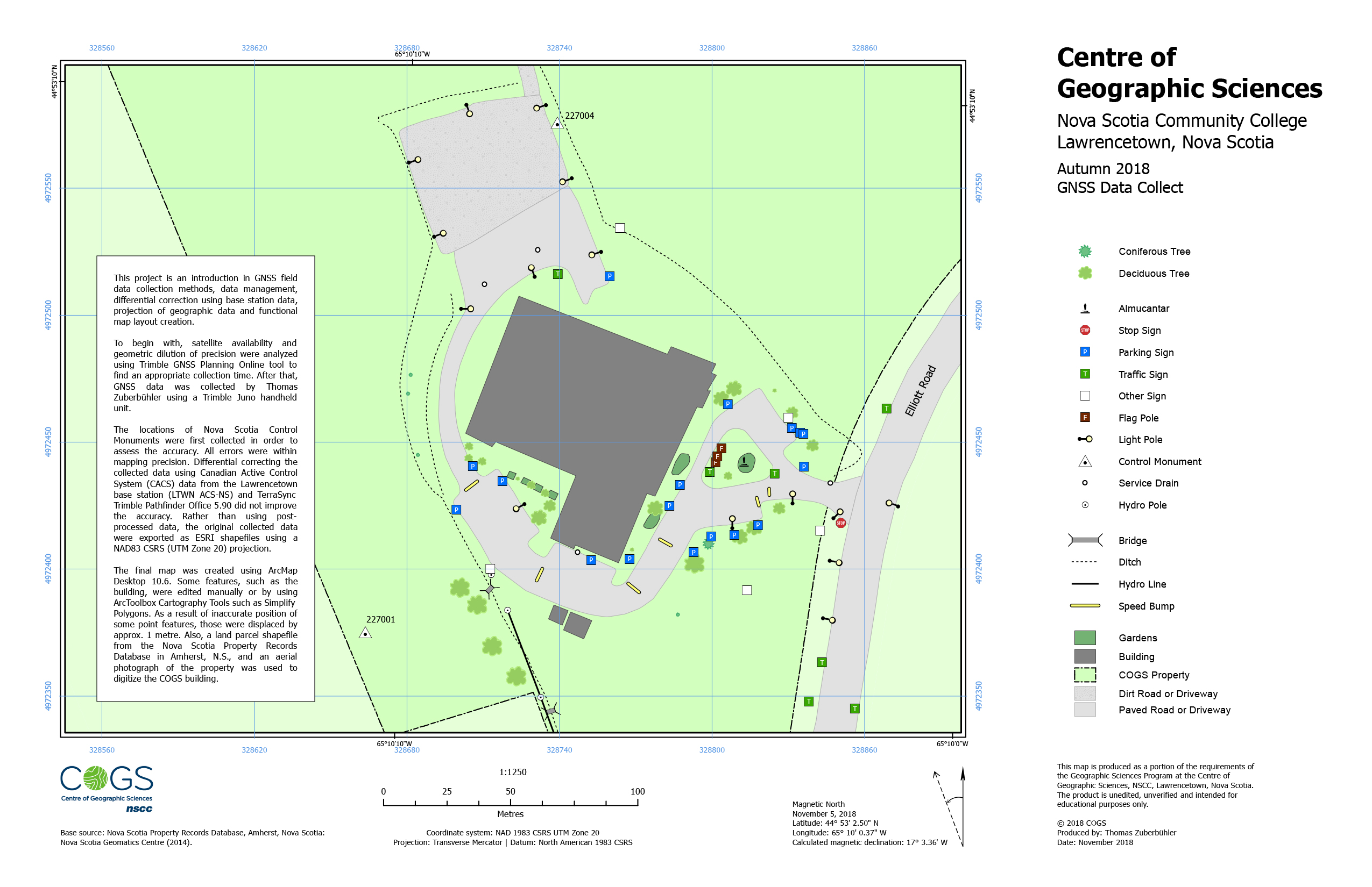
Equipped with a GPS device, the COGS building, sheds, parking lot, gardens, signs and street lights were digitized. The project was an introduction in GNSS field data collection methods, data management, differential correction using base station data, projection of geographic data and functional map layout creation.
Preparation
Before heading out for data collection, a data dictionary was created. This ensured data quality and simplified data input while collecting features through constraints.
Data Collection
To begin with, satellite availability and geometric dilution of precision were analyzed using Trimble GNSS Planning Online tool to find an appropriate collection time. After that, GNSS data was collected by me using a Trimble Juno handheld unit.
Differential Correction
The locations of Nova Scotia Control Monuments were first collected in order to assess the accuracy. All errors were within mapping precision. Differential correcting the collected data using Canadian Active Control System (CACS) data from the Lawrencetown base station (LTWN ACS-NS) and TerraSync Trimble Pathfinder Office 5.90 did not improve the accuracy. Rather than using post-processed data, the original collected data were exported as ESRI shapefiles using a NAD83 CSRS (UTM Zone 20) projection.
Map Creation
The final map was created using ArcMap Desktop 10.6. Some features, such as the building, were edited manually or by using the geoprocessing Cartography tools such as Simplify Polygons. As a result of inaccurate position of some point features, those were displaced by approx. 1 metre. Also, a land parcel shapefile from the Nova Scotia Property Records Database in Amherst, N.S., and an aerial photograph of the property was used to digitize the COGS building.
Software, Technology, Data Sources and Skills
- Data Collection with a Trimble Juno Handheld Unit
- TerraSync Trimble Pathfinder Office 5.90
- ArcMap 10.6
- Differential Correction using the Canadian Active Control System (CACS)